Dataja:WorldMapLongLat-eq-circles-tropics-non.png
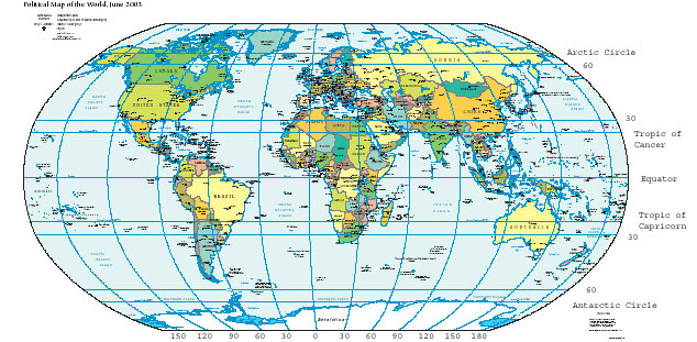
WorldMapLongLat-eq-circles-tropics-non.png (634 × 311 pikselow, wjelikosć dataje: 93 kB, MIME-Typ: image/png)
Stawizny dataje
Tłoc na datum/cas aby tencasna wersija se lodowała.
| datum/cas | Pśeglědowy wobraz | rozměry | Wužywaŕ | Komentar | |
|---|---|---|---|---|---|
| něntejšny | 12. nowembra 2015, 14:54 |  | 634x311 (93 kB) | OgreBot | (BOT): Reverting to most recent version before archival |
| 12. nowembra 2015, 14:54 |  | 634x311 (93 kB) | OgreBot | (BOT): Uploading old version of file from en.wikipedia; originally uploaded on 2004-06-09 02:02:20 by Niteowlneils | |
| 8. februara 2006, 10:59 |  | 634x311 (93 kB) | Freshstart~commonswiki | Great circles of latitude. Originally uploaded to [http://en.wikipedia.org/wiki/Image:WorldMapLongLat-special-lats-emph-AntarcticCircle-non.png] by en:User:Niteowlneils. Based on PD image from US government. This series should have migrated to common |
Datajowe wužywanje
Slědujucy bok wótkazujo na toś tu dataju:
Globalne wužywanje datajow
Slědujuce druge wikije wužywaju toś ten wobraz:
- Wužywanje na ace.wikipedia.org
- Wužywanje na af.wikipedia.org
- Wužywanje na am.wikipedia.org
- Wužywanje na anp.wikipedia.org
- Wužywanje na an.wikipedia.org
- Wužywanje na ar.wikipedia.org
- Wužywanje na arz.wikipedia.org
- Wužywanje na ast.wikipedia.org
- Wužywanje na awa.wikipedia.org
- Wužywanje na bg.wikipedia.org
- Wužywanje na bn.wikipedia.org
- Wužywanje na bs.wikipedia.org
- Wužywanje na ca.wikipedia.org
- Wužywanje na ca.wikibooks.org
- Wužywanje na ceb.wikipedia.org
- Wužywanje na da.wikipedia.org
- Wužywanje na de.wikipedia.org
- Wužywanje na dty.wikipedia.org
- Wužywanje na el.wikipedia.org
- Wužywanje na en.wikipedia.org
- Wužywanje na en.wikibooks.org
- Wužywanje na en.wikiversity.org
- Wužywanje na en.wiktionary.org
- Wužywanje na eo.wikipedia.org
- Wužywanje na es.wikipedia.org
- Wužywanje na eu.wikipedia.org
Dalšne globalne wužywanje toś teje dataje pokazaś.


