Dataja:Zugspitze Airview 01.jpg

Originalna dataja (2.814 × 2.111 pikselow, wjelikosć dataje: 4,12 MB, MIME-Typ: image/jpeg)
Zespominanje
| wopis |
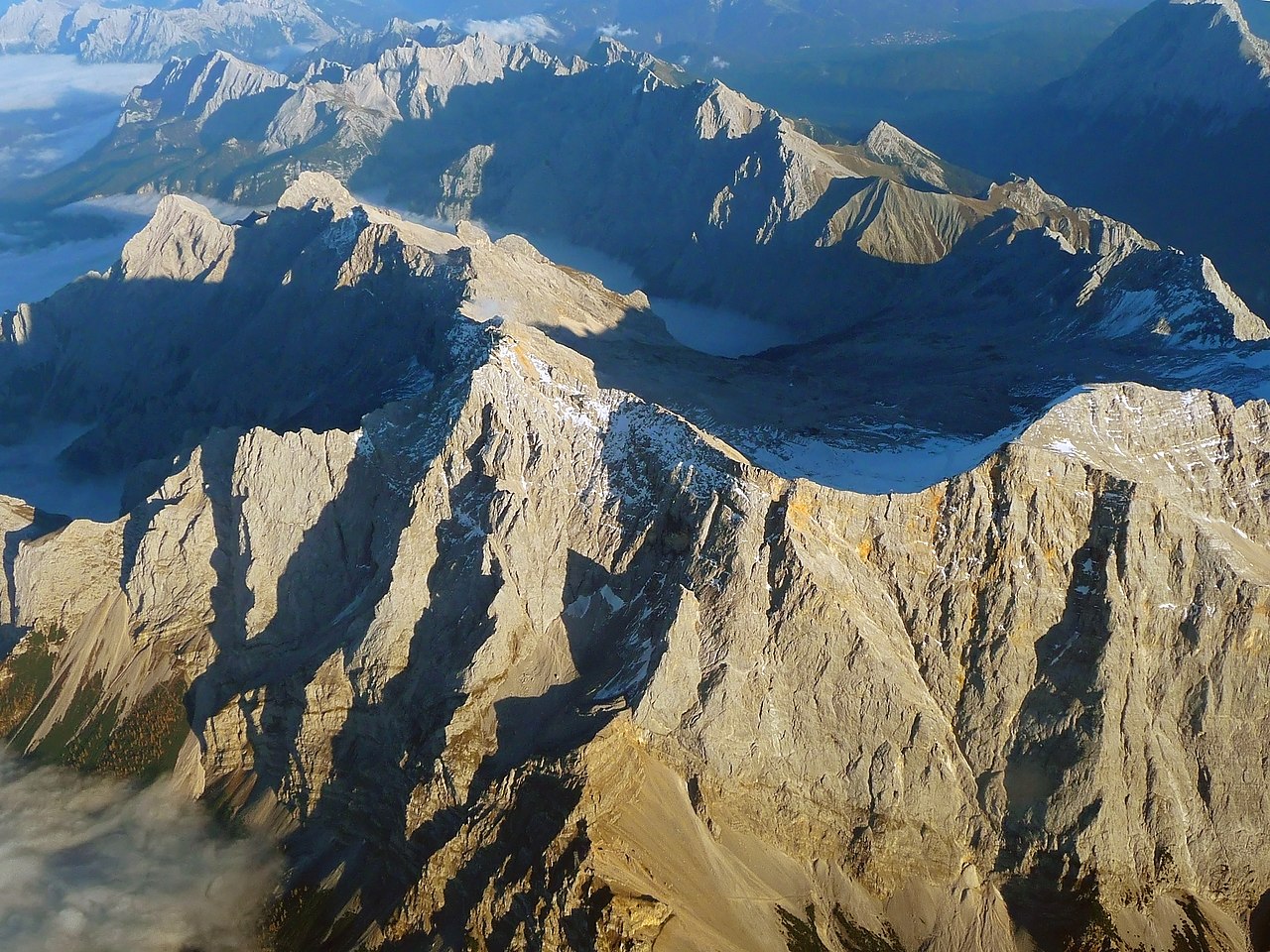
English: The "Zugspitze", the highest mountain in Germany as seen from an aircraft. View from West, with mountains in Wetterstein around and valley Reintal with fog or clouds from above.
Deutsch: Die "Zugspitze", der höchste Berg Deutschlands aus einem Flugzeug gesehen. Der Hauptgipfel des Wettersteingebirges ist umgeben von tieferliegenden Graten wie dem Jubiläumsgrat, dem Schneefernerkopf rechts neben dem Gipfel in der Mitte, mit dem Zugspitzplatt und dem steil abfallenden Reintal dahinter, die beide bereits im Schatten des späten Nachmittags liegen. Oktober mit Sonne auf dem Gipfel. |
| Datum | |
| Žrědło | Swójske źěło |
| Awtor | Africaspotter |
| Pozicija kamery | | Tónle a dalše wobrazy pola: OpenStreetMap |
|---|
Licencěrowanje
- Smějoš:
- gromaźe wužywaś – źěło kopěrowaś, rozšyriś a dalej daś
- změšaś – aby źěło pśiměrił
- Pód slědujucymi wuměnjenjami:
- pśipokazanje – Musyš źěło pó wašni pśipokazaś, kótaruž awtor abo licencowaŕ jo pódał (ale nic pó wašni, až by se gódało, až wón tebje abo twójo wužywanje źěła schwalijo).
- źěliś – Jolic měnjaš, pśetworjaš toś to źěło abo na njo natwarjaš, móžoš gótowe źěło jano pód teju sameju licencu ako toś ta rozšyriś.
1. Online-Medien:
2. Print-Medien:
Ich bitte um Zusendung eines Belegexemplares bzw. der URL, wo das Foto benutzt wird. Bitte schreiben Sie eine E-Mail, wenn Sie meine Adresse für die Zusendung eines Belegexemplares benötigen oder weitergehende Fragen zur Lizenznutzung haben. Eine Auswahl meiner Fotos finden Sie auch auf www.felixgottwald.net. |
1. Online media:
2. Print media:
Please send me a specimen copy or the URL of the website where the image is used. Please write an email, if you need my postal address for sending a specimen copy or have further questions regarding the terms of licence. You may also find a selection of my photos at www.felixgottwald.net. |
| Annotations | This image is annotated: View the annotations at Commons |
Stawizny dataje
Tłoc na datum/cas aby tencasna wersija se lodowała.
| datum/cas | Pśeglědowy wobraz | rozměry | Wužywaŕ | Komentar | |
|---|---|---|---|---|---|
| něntejšny | 13. oktobra 2010, 21:00 | | 2.814x2.111 (4,12 MB) | Africaspotter | {{Information |Description={{en|1=The "Zugspitze", the highest mountain in Germany as seen from an aircraft.}} {{de|1=Die "Zugspitze", der höchste Berg Deutschlands aus einem Flugzeug gesehen.}} |Source={{own}} |Author=[[User:Africaspotter|Africaspotter] |
Datajowe wužywanje
Slědujucy bok wótkazujo na toś tu dataju:
Globalne wužywanje datajow
Slědujuce druge wikije wužywaju toś ten wobraz:
- Wužywanje na be.wikipedia.org
- Wužywanje na bg.wikipedia.org
- Wužywanje na bs.wikipedia.org
- Wužywanje na cs.wikipedia.org
- Wužywanje na de.wikipedia.org
- Wužywanje na en.wikipedia.org
- Wužywanje na eo.wikipedia.org
- Wužywanje na et.wikipedia.org
- Wužywanje na eu.wikipedia.org
- Wužywanje na fi.wikipedia.org
- Wužywanje na fr.wikipedia.org
- Wužywanje na gl.wikipedia.org
- Wužywanje na he.wikipedia.org
- Wužywanje na hsb.wikipedia.org
- Wužywanje na hu.wikipedia.org
- Wužywanje na id.wikipedia.org
- Wužywanje na is.wikipedia.org
- Wužywanje na it.wikipedia.org
- Wužywanje na ja.wikipedia.org
- Wužywanje na lt.wikipedia.org
- Wužywanje na mr.wikipedia.org
- Wužywanje na ms.wikipedia.org
- Wužywanje na nl.wikipedia.org
- Wužywanje na no.wikipedia.org
- Wužywanje na pl.wikipedia.org
- Wužywanje na pnb.wikipedia.org
- Wužywanje na pt.wikipedia.org
- Wužywanje na ro.wikipedia.org
- Wužywanje na simple.wikipedia.org
- Wužywanje na sk.wikipedia.org
- Wužywanje na sv.wikipedia.org
- Wužywanje na tr.wikipedia.org
- Wužywanje na uk.wikipedia.org
- Wužywanje na vi.wikipedia.org
- Wužywanje na zh.wikipedia.org